


 24/7 Emergency Service
Preparing to assist after the storm
2/7/2019 (Permalink)
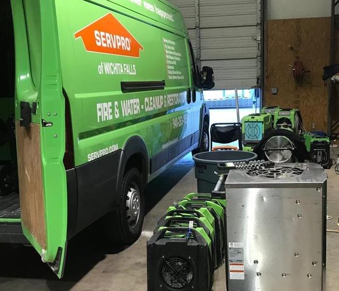 One of hundreds of pieces of equipment SERVPRO of Wichita Falls is loading in preparation for Storm Team assistance after arctic blast hits Midwest.
Wind chills of -15 degrees forecast for central Iowa today, as can be seen in the National Weather Service advisory posted below.
Your SERVPRO of Wichita Falls team is loading up equipment and supplies, ready to assist the SERVPRO Disaster Recovery team.
The SERVPRO Disaster Recovery Team can provide help whether you're dealing with a tornado, hurricane, blizzard or flood. The SERVPRO System has a network of strategically positioned storm teams on standby should a disaster strike near you. Available 24 hours a day and 365 days a year, we are prepared for the unpredictable.
With the ability to mobilize local command centers, along with the resources of more than 1,700 Franchises nationwide, no disaster is too big. Recent mobilizations of the Catastrophic Storm Response Teams include:
- 2014 Polar Vortex
- 2012 Sandy
- 2010 Nashville floods
- 2008 Ike
- 2007 Chicago floods
- 2007 Ohio floods
- 2007 California wildfires
- 2005 Katrina/Wilma/Rita
URGENT - WINTER WEATHER MESSAGENational Weather Service Des Moines IA401 AM CST Thu Feb 7 2019...Significant Winter Storm Will Continue to Impact the StateToday with Dangerous Wind Chills Tonight....After a band of moderate freezing rain, sleet, and snow passedover central Iowa earlier this morning, primarily freezing drizzleand light snow or flurries prevails at this time. The next roundof heavier precipitation is over northern Missouri and will bemoving into Iowa before sunrise. This will spread freezing rainperhaps mixing with sleet over southeast portions of Iowa withsignificant ice accumulations still possible in this area throughmidday today. Farther to the north and west, any lingeringfreezing drizzle will change to snow and then spread eastward thismorning.Strong northwest winds will develop by midday Thursday causingblizzard conditions over northern Iowa this afternoon into thisevening. In the southeast, there is a potential for tree damageand power outages where significant ice accumulation occurs.Hazardous driving conditions are expected over much of the regiontoday into this evening.Another round of bitter cold wind chills arrives late today intoFriday morning. Wind Chill Advisories and Warnings will be neededover much of central Iowa.